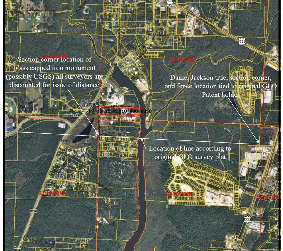
The Big Picture - south line of 15 and 16
The images shown below are taken from twww.http://waltonpa.com and is the Walton County Tax Assessors Map showing one of the many areas of dispute within 1 South 19 West. We have added the white wording and line for comparison purposes. The red lines shown represents Section line locations according to the 1970 USGS Freeport Quadrangle. The white line shown represents the Section line location according to the GLO Plat, a chain of title with ancient fence tied to an original Patent holder, and a monument possible placed by the USGS for the creation of the 1970 Freeport Quadrangle.
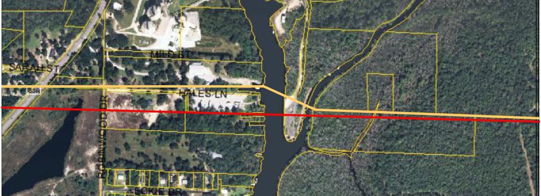
On the image below, the red line is the USGS section line location according to the Tax Appraiser's web site. The yellow line is the current County Line as ordered by the
Judge. Both lines are not in the correct location when compared to the original TRS grid, which falls far south of the junction of the 2 creeks - as shown above.